The Ten Most Beautiful Hikes in the World
Our trails columnist has hiked thousands of miles. These are the routes at the top of his bucket list. Thrill yourself with a trip to an amazing trail this year.
New perk: Easily find new routes and hidden gems, upcoming running events, and more near you. Your weekly Local Running Newsletter has everything you need to lace up! .
The map that has become a meme first began arriving in text messages, emails, and social media tags at least four years ago. Maybe you’ve seen it online, too—a Google Maps screenshot of the globe with a blue line that curves nearly 14,000 miles northward from Cape Town, South Africa to Magadan, Russia, arcing like a launched rocket through zones of extreme geopolitical turmoil. It is, allegedly, “the world’s longest continuous walk,” a fact I’ve never bothered to vet despite the dozens of friends who’ve sent it my way. I’m not very interested.
It’s true that I love walking long distances, whether that means going from Mexico to Canada via the Pacific Crest Trail or traversing entire states like Florida and Arizona a month at a time. But for me, hiking is a means to an end, never the end itself. I don’t want to walk the longest continual path so much as the most impactful ones, the ones that show me nature and beauty, myself and others, the present and especially the past from some surprising vantage. I suppose this viral trek would do the trick, but I’m not sure if it’s the best or most efficient way to encounter the unexpected I crave, at least compared to these ten hikes I’m determined to do in my time.
Destinations Newsletter
Want more of �����ԹϺ���’s Travel stories?Rakiura Track, New Zealand

Distance: 20 miles
Time to Tackle: Three days
Terminus: Near Oban
Look at a map of Te Araroa, a 1,900-mile path that splits both the North and South Islands horizontally. Notice the dot of land just beneath the trail’s southern terminus? That’s Stewart Island, or , home to an eponymous national park and perhaps the most enticing of New Zealand’s ten Great Walks: the Rakiura Track. Kiwis take “tramping” seriously, devoting so many public resources to developing, protecting, and maintaining their routes that Americans can only be envious—or at least visit. Consider the Rakiura, which winds along near a series of bays and inlets (head out at night to look for kiwi feeding) and heads into forests of towering rimu. Enjoy three days of slow walking and reverie on isolated beaches, and choose from multiple huts (think Appalachian Trail shelters, but sturdy and clean) and campsites, ranging from $5 to $60 per night. And while I do love hiking in ankle-deep mud, officials work hard to curb the bog’s creep by packing down the trail. Thanks to flipped hemispheres, you’ll want to trek Rakiura—or tack it onto the Te Araroa—between October and March, when stateside hiking opportunities dwindle.
Greater Patagonian Trail, Chile and Argentina
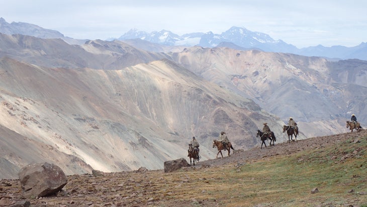
Distance: 1,900 miles
Time to Tackle: A lifetime
Termini: Santiago, Chile (north), and Navarino Island, Chile (south)
I often lament that much of my hiking life happens on established trails, following routes that can be navigated via maps on apps. But what would it be like to really explore, to feel the frontier of modern adventure? For the next several years, the Greater Patagonian Trail should provide some answers. Dreamed up by German engineer Jan Dudeck and his dauntless Chilean wife Meylin Ubilla over almost two decades, the GPT, despite its name, is less a trail than a confederation of cattle paths, tiny roads, and otherwise unmarked expanses that you must make your own way through. Sure, the Pan-American Highway and Chile’s Route of Parks can guide you deep into some of the least developed parts of the planet, but no journey questions and expands the philosophical underpinnings of hiking quite like this one does. Can you negotiate your way through private land in Spanish? Can you slow down and embrace local culture and astounding beauty without feeling the American compulsion to finish, let alone finish fast? Can you accept failure, the most common GPT outcome, as a variety of success? With its stunning diversity of terrain and dependence on diplomacy, the GPT might be my ultimate trail—the one that, when I’m ready to commit, could be my final trek. Good thing Dudeck and Ubilla have yet to settle on its ends.
Ocean to Lake Trail, Florida
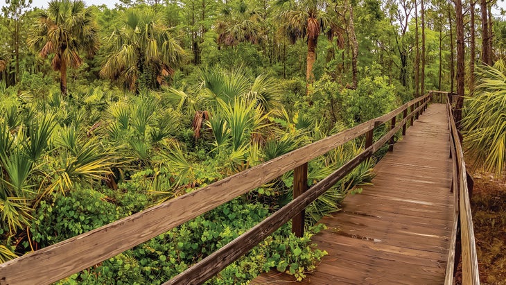
Distance: 61 miles
Time to Tackle: Four days
Termini: Lake Okeechobee (west) and Hobe Sound Beach (east)
I’m cursed to be a completist. The trait becomes arduous with through-hiking, where the desire to finish every side jaunt quickly piles on the miles. If hiking is partly about minimizing what you need, maybe I can learn to let completeness go, too? Some winter soon, I’ll head south to the Ocean to Lake Trail, a fee-free, west-east offshoot of the 1,200-mile Florida Trail, a playground of swamps and sand, cypresses and pines. The Florida Trail is as fun and uncanny as American through-hiking gets, but it’s also a monthlong negotiation with alligators and grotesque, blistered feet. This sampler offers plentiful campsites, nearby restaurants (it’s South Florida—always go to the Mexican spot), and cell service, so you can post trail pics for your adoring masses to enjoy. Although Florida is infamous for ceaseless strip malls and ostentatious development, its woods and wetlands remain among the wildest places in the U.S. This lush little corridor proves it.
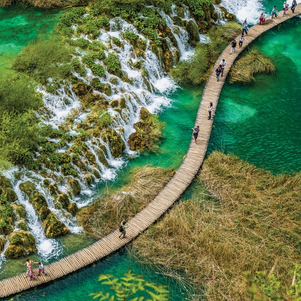
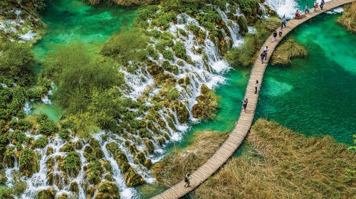
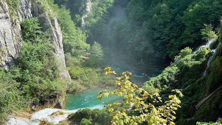
Route K, Plitvice Lakes National Park, Croatia
Distance: 11 miles
Time to Tackle: Five hours
Terminus: Entrance Station 1
To glimpse —a chain of sapphire and emerald jewels cut into karst and connected by streams, many of them subterranean—is to wonder whether you’ve wandered into an AI-generated simulacrum of natural beauty. Not only are these gems at the core of Croatia’s oldest national park, but you can see many of them during day hikes on a network of serpentine trails. The longest one, Route K, is a circuit among the lower and upper lakes; it spools around the awe-inspiring Jezero Kozjak, like a Lake of the Ozarks retouched in Photoshop, and leads you across a series of boardwalks—ideal platforms to take in an unbelievable panorama of verdant forests, towering waterfalls, cascading seeps, and sprawling tufa embankments. Despite the place’s popularity (it’s affordable, and a quick trip from the Adriatic Sea, which separates this coastline from Italy), wolves, black bears, and wildcats prowl the landscape, a rarity in Europe. There’s a nominal entrance fee; otherwise, you’re free to roam.
Backbone Trail, California
Distance: 67 miles
Time to Tackle: Three to five days
Termini: Point Mugu (west) and Will Rogers State Historic Park (east)
Tell people you hiked the Pacific Crest Trail and they’ll wonder how many times you saw the ocean. (Answer: zero.) So here’s your chance to admire the big blue expanse from several thousand feet above Los Angeles. zigs and zags across the Santa Monica Mountains, just north of the lavish homes of Malibu, before descending to coastal coves. Slicing through a rare safeguarded stretch of Mediterranean ecosystem, this is arguably the country’s most anomalous trail—public land with ocean views, in an area where private interests buy up every scrap of acreage. During the pandemic, the Backbone became a hot spot on the fastest-known-time circuit, with runners racing it in ten hours. Assuming you’re not pursuing such a record, know that campsites are infrequent. So have a friend pick you up at day’s end, or recruit a guide via the Santa Monica Mountains Trails Council to lead you and secure lodging, though it could cost upwards of $500. Otherwise, if night sets in and you’re out of options, you’ll need to burrow in among the chaparral; if anyone asks, you’re from Calabasas.
Chilkoot Trail, Alaska
Distance: 33 miles
Time to Tackle: Two to five days
Termini: Dyea, Alaska (south), and Bennett Lake, British Columbia (north)
From battlefield paths to Appalachian gaps, I love historic trails—journeys that foster a visceral connection with the past in ways books can’t. Exemplary in that regard is the , a Tlingit trade route across the Coast Mountains that bustled with prospectors racing from Alaska into Canada’s Yukon during the Klondike gold rush. Officials weighed their gear just below Chilkoot Pass to ensure that they were bringing enough food and supplies for the expedition ahead. Remnants of this American avarice litter the trail, which, if you’re heading south to north, climbs from a gold-rush ghost town to the Canadian border before descending to mountain-bound Bennett Lake. (“The world’s longest museum,” the National Park Service calls it.) You’ll need a permit ($60) to overnight at the many otherwise free campgrounds. The trail’s international border was closed in 2022, and the trail itself was damaged by floods in October, though the entire thing is expected to reopen in August of this year. If you want to attempt the entire trek, double-check the status before you start—you’re here for a Klondike gold bar, after all.
For more ideas on spectacular Alaska hiking, check out our recommendations in The Best Places to Visit in the U.S.
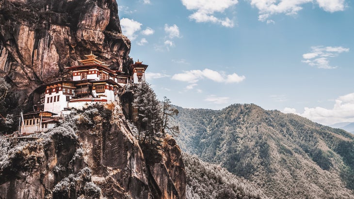
Trans-Bhutan Trail, Bhutan
Distance: 250 miles
Time to Tackle: 35 days
Termini: Haa (west) and Trashigang (east)
Apart from their traditional uses, historic trails fascinate me because they often involve a renaissance story that occurred long after they were supplanted by train tracks or highways. Case in point: the , used by royal couriers, soldiers, and religious pilgrims for half a millennium before parallel road construction led to disuse and disrepair in the 1950s. Last September, the eastern Himalayan nation reopened the route after substantial fixes by a small army of trail builders. Few places in the world offer an experience of a culture this distinct, especially on foot. When Bhutan, a Buddhist and matrilineal society, opened its borders to tourists in 1974, it revealed rich folklore, verdant expanses of uncut forests, and ornate temples and fortresses tucked into cliffside crags. As you make your way across sweeping valleys, through cramped passes, and into welcoming villages, you can look forward to sharing hearty meals like ema datshi—a stew of cheese and chilies—with the people who made them. The Trans-Bhutan Trail strings together such experiences (along with possible sightings of red pandas, Bengal tigers, and Asiatic black bears) like an ancient charm necklace. Save up, though, since a local guide is required. A five-day trek through a remarkable section near Paro is just $375, but a through-hike will run you around $20,000—cheaper at least, and less cliché, than an attempt on Mount Everest.
Sinai Trail, Egypt
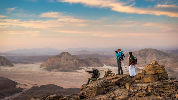
Distance: 340 miles
Time to Tackle: 50 days
Termini: Serabit el-Khadim (west) and Ras Shaitan (east)
“How many trails do you have left?” friends always ask. But how can I reach the proverbial trail’s end when new ones appear every year? To wit, in 2015 three Bedouin tribes on Egypt’s storied Sinai—the land bridge between Africa and Asia—banded together to introduce an amazing 140-mile route from the Red Sea to the country’s highest summit, 8,600-foot Gabal Katrine. With proof of concept and new revenue bolstering a region not frequented by tourists, organizers soon got five more tribes on board and expanded the trail by 200 miles. The Sinai traces an austere desert landscape beneath massive skies. What’s out there? Tiny chapels and abandoned mines, Martian-like rock outcroppings and near tropical oases, serrated mountains and slot canyons. Due to local custom, and an attempt to create an economic boom in an area that sees few of them, you’ll hike with Bedouin guides, your gear and water ferried by camels that, yes, you can ride. Each of the four sections takes about a dozen days to complete and costs a little over a grand, an absolute bargain in the realm of international accompanied treks. The first official through-hike is set for autumn 2023 with local outfitter . While the trip is high on my list, it’s going to have to wait, because terrorism remains a threat in the region; at press time the U.S. government advised against travel in the Sinai. Check with the State Department’s Bureau of Consular Affairs before you book.
Hayduke Trail, Utah and Arizona
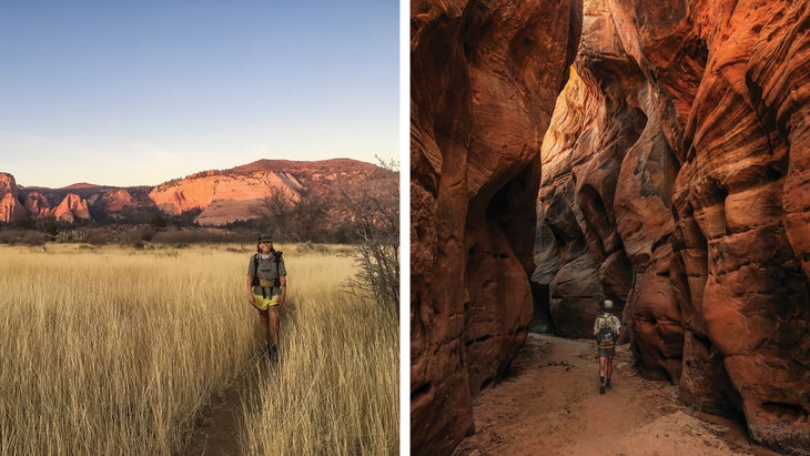
Distance: 812 miles
Time to Tackle: Two months
Termini: Arches National Park (east) and Zion National Park (west), both in Utah
George Washington Hayduke is the justifiably spiteful hero of Edward Abbey’s , a comical, canonical manifesto of guerrilla environmental resistance. I have a suspicion Hayduke would approve of now bearing his name. An unsanctioned route that rambles across the mighty sandstone mesas, canyons, and monoclines of the lower Colorado Plateau, the Hayduke traverses public land, including five national parks. With its river crossings, treacherous descents, barely-there pathway, dearth of resupply options, and general water scarcity, it may be the most demanding trek in America. The commensurate beauty, however, is a testament to the no-guts-no-glory credo that compelled Hayduke (and maybe got him killed). At least it’s free, as Hayduke would have wanted. This is the trail I most covet, but even as I near 10,000 total miles on foot, I don’t know that I’m ready yet. My motto, should the time come: Prepare to go through hell to see the Southwest’s heaven.
Olomana Trail, Oahu

Distance: 4.4 miles
Time to Tackle: Four hours
Termini: Olamana Ridge Trailhead (north) and Ahiki (south)
The City of Honolulu recently posted a pair of signs at the famed Olomana Trailhead in eastern Oahu, but these weren’t a polite guide to trail etiquette. “Six people have fallen to their deaths after hiking past the first peak,” read the top placard, a stern preamble to a second sign listing the dates and locations of the accidents. The trail, just ten miles from the capital, is part of the island’s incredible free recreational network—which is to say that, despite the signs, you can legally hike it. But it’s worth considering whether you’re up for the challenge. Named for the first of three steep and narrow summits, linked by a short but harrowing path lined with guide ropes, Olomana is one of the most polarizing trails in the U.S. It’s trumpeted by adrenaline junkies, who also champion the sweeping coastline views that such extreme exposure allows, but scorned by those who see it as a potentially fatal magnet for YouTube bros. Maybe it’s both.
Map It
Nothing gets us excited about a hike more than a good map
And there’s no better backcountry map out there than Gaia GPS. For the ten hiking routes featured here—many of them in places where cell service may be nonexistent and advanced beta on terrain and logistics could be a lifesaver—you can download detailed Gaia GPS trail maps for offline use, so you always find your way. Gaia Topo’s interactive maps set the standard for clarity and detail, and help you locate campgrounds, scenic overlooks, water sources, and summits. Precise weather forecasts are available by tapping the map, and you can leave a breadcrumb trail of your progress, in case you want to take that detour to a waterfall and still find your way back. Once you’re home again, relive the whole experience in 3D on . Bonus: �����ԹϺ���+ members get access to all these routes—and millions more trails worldwide—along with Gaia GPS’s safety tools, giving them everything they need to get after it with confidence. (Disclosure: Gaia GPS is owned by �����ԹϺ��� Inc., which also owns �����ԹϺ��� magazine.) —Tasha Zemke