

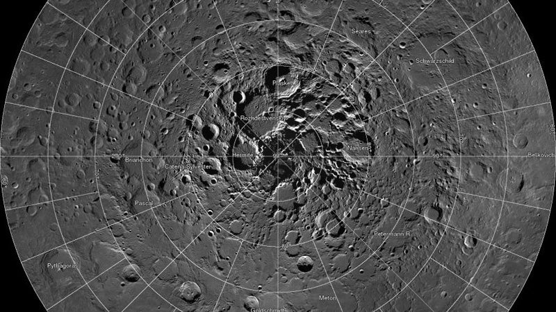
Cartographers and aspiring astronauts alike, check this out. NASA has released a free online high-resolution map of the moon’s north pole.
As our friends over at , NASA’s Lunar Reconnaissance Orbiter started compiling the images to make the map back in 2009. Now, 10,581 images later, the agency has released an interactive map that is a digital mosaic of all the pictures the spacecraft took.
The ostensible purpose of the mapping mission was to plan landing spots for future missions and to analyze the moon’s soil composition, but most of us plebes will just find the map to be darn cool. Each of the map’s 681 pixels represents two meters; in other words, the detail of this map is extraordinary. For perspective, the map represents a circular area close to a fourth of the continental United States. When superimposed on a map of the Lower 48, the moon map stretches from Utah to Illinois and from North Dakota to Texas. We’re talking Google Earth–level detail, but for the moon.
To capture the images, the LRO hovered over the same latitude for a month and snapped a picture every two hours. As the moon rotated beneath it, the spacecraft photographed every part of one latitude, and then moved on to the next one. This produced what’s known as a collar mosaic.
Well, what are you waiting for? Explore the moon from the comfort of your living room .