The Lonely Beauty of the West’s Largest Unprotected Wilderness
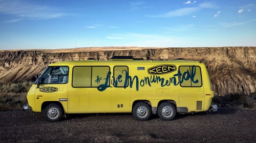
In August 2015, four marketing professionals drove a bright yellow 1976 GMC RV named Teddy north from Nevada into the Owyhee Canyonlands—an area larger than Yellowstone, tucked into Oregon’s sparsely inhabited southeastern corner. As employees of Portland footwear company Keen, their mission was for a decade-long grassroots campaign to protect the 2.5-million-acre swath of volcanic moonscapes, redrock canyons, bighorn sheep, and pristine rivers with a national monument designation by documenting its beauty (and yes, probably sell a few shoes in the process). But when this remote quarter of America finally garnered the nation’s attention six months later, it was for the armed occupiers who took over the neighboring Malheur National Wildlife Refuge in a statement against federal land protections.
As President Obama left office, the West’s largest intact tract of wilderness remained vulnerable to industrial development. The wildlife refuge occupation rekindled strong anti-public land sentiment and, in Washington, a new Congress aiming to rewrite the rulebook on public lands may open the area to mining, petrochemical, and other interests with a simple vote. These are worrying developments for the Oregon Natural Desert Association (ONDA), a leading member of a coalition of conservation groups and advocates that includes the Pew Charitable trusts, the Sierra Club, and the Wilderness Society. And with the current political climate, they’ll likely have to find a new path forward. But as these photos show, protecting the Owyhee’s primal grandeur is worth the effort.
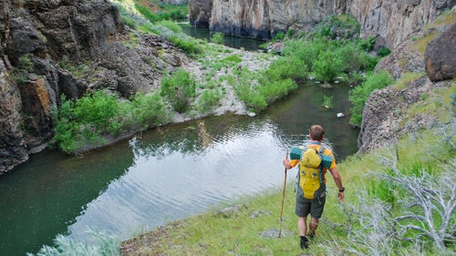
It’s no accident Owyhee—pronounced ”oh-why-hee,” or “oh-wah-hee”—sort of sounds like our 50th state. When three Hawaiian fur trappers disappeared in this river basin in the late 1800s, their comrades named the watershed and its soaring highlands in their honor. Today, the Owyhee Canyonlands are about as isolated as you can get in the lower 48. Malheur County’s population density amounts to three souls per square mile. No markers guide Owyhee River rafters or Oregon Desert Trail thru-hikers, and the night skies are among the least light polluted on earth.
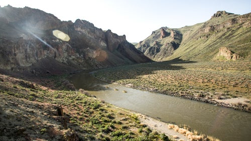
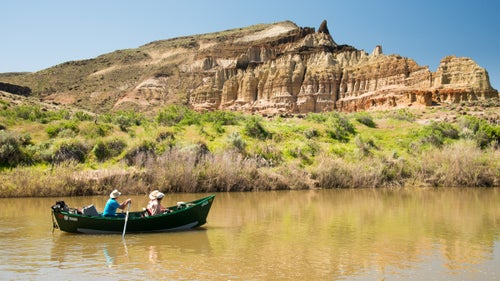
With headwaters in Nevada’s far north, the Owyhee River first winds through southwest Idaho’s high desert before crossing into Oregon. Near the state line, the river begins to cut deep—rushing some 150 miles through seas of bunchgrass and slot canyons that can reach 1,000 feet high—before flowing back east to Idaho to meet the Snake River.
Only three paved roads penetrate the Canyonlands’ interior. Such remoteness has long protected the region, says the coalition’s non-profit Wild Owyhee. Two years ago, the group unveiled a conservation proposal that called for the protection of 2.5 million acres through a combination of National Conservation Area, Wilderness, and Wild and Scenic River designations, noting that development pressure is “now clawing at its edges.”
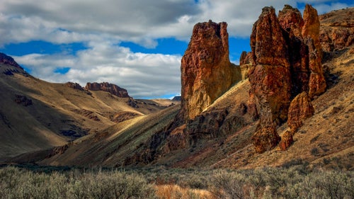
Six distinct volcanic eruptions created the Owyhee’s striated moonscapes as vast lava dams pooled and diverted water. In addition to ancient veins of clay and quartz, the region is rich in natural gas, gold, silver, and uranium. The Bureau of Land Management owns 95 percent of the land the coalition hopes to protect, and there are already four active mines within the boundaries of the proposed monument. Petrochemical interests are already proliferating on the Owyhee’s northern edge and just across the Idaho border.
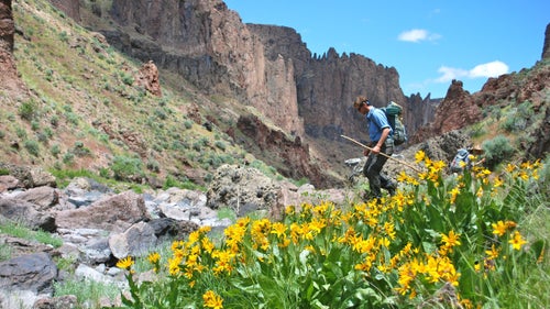
From Packard’s blazingstar and the grimy mousetail to the bulbous Owyhee clover, the canyonlands are home to 28 endemic plant species. But flowering plants aren’t the only rare specimens thriving in this sagebrush sea. One of the largest, and last herds of California bighorn sheep roam here, and the buxom greater sage-grouse—a longtime candidate for listing on the Endangered Species Act—hide deep in the brush.
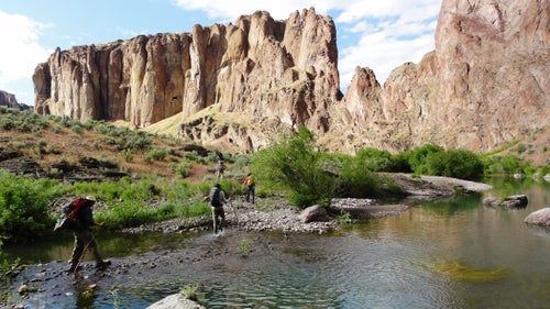
More of a concept than an official route, the Oregon Desert Trail travels 750 miles through the state’s most sparsely populated public lands and legal rights-of-way. Entirely unmarked, the 200 miles that pass through the Owyhee Canyonlands are some of the route’s most rugged thanks to numerous river crossings and canyon scrambles, not to mention frequent rattlesnake sightings.

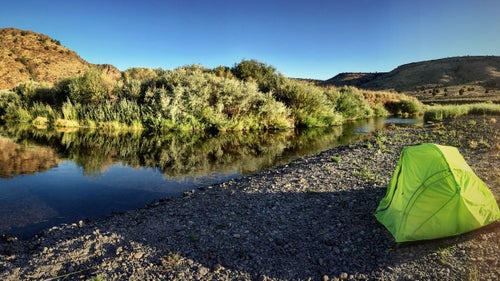
Entering the Canyonlands from the southwest, the West Little Owyhee—home to native redband trout, raptors, and bats—is protected as a Wild and Scenic River. This designation means that unlike the BLM land just beyond its banks, federal law permanently protects the river from its headwaters just north of the Nevada border to its confluence with the main Owyhee some 57 miles later.
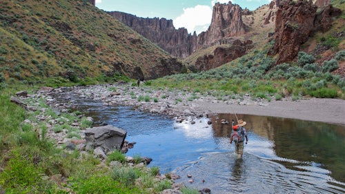
Although 180 miles of river within the Owyhee Canyonlands are Wild and Scenic, Ross Putnam, co-founder of Portland-based Base Camp Brewing Company, wants to see more of the region’s waterways given permanent protection. This past February, Base Camp and 27 other Oregon brewers lobbied the state’s senators for the Canyonlands’ conservation. “Yes, beer is hugely dependent on water,” says Putnam. “But the Owyhee is different. We’re not sourcing water there—it’s just part of our ethos. That resource, and its protection, are huge for us.”
Here, some 30 miles from the Owyhee’s proposed northern border, violent volcanic explosions hollowed out the caldera surrounding Leslie Gulch, creating tuff towers and porous honeycomb structures. The vistas here stretch for miles, says Base Camp’s Putnam, who’s made several treks into the Owyhee since ONDA first solicited his help to raise awareness back in Portland. Though the Owyhee’s shot at national monument status seems lost for now, Putnam says Oregon’s brewers will continue the fight. “If anyone has the will to keep going, it’s brewing industry.”