Fire and Ice: Tracking a Glacier’s Tragic Decline
With petroleum as his paint, English photographer took to Africa’s second highest peak, Mount Kenya, to outline the mountains’ vanishing Lewis Glacier. Using old maps and meticulous GPS plotting, the fire lines represent an old section of the glacier, often a large distance from the glacier’s current front. Norfolk’s work, completed in 2014, is marked by grief but he hopes it also serves as a call to action. In his words, to think that “in ten or twelve years this magnificent glacier that has endured for millennia will exist only in photographs, is unbearable.”
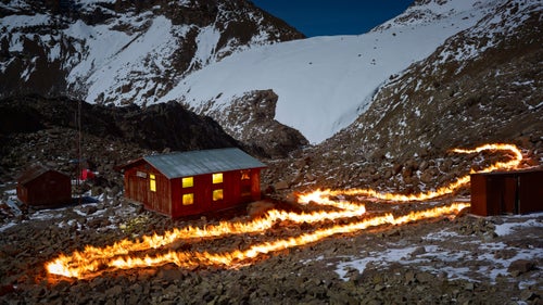
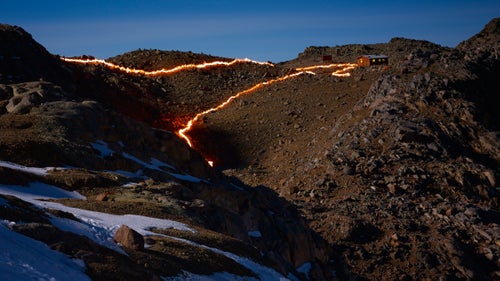
Photo: Norfolk was born in 1963, the year of the glacier’s position depicted by this fire line. At that time only the small hut on the left existed. The larger structure with the lights on, called the Austrian Hut, was built in 1972 and served as Norfolk’s residence during this project in 2014.
Norfolk worked with the nonprofit organization to overlay GPS coordinates with historical data and maps, from which he plotted the glaciers previous edges and planned locations for his images.
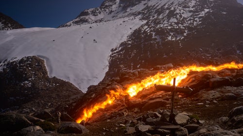
This portion of the glacier has receded more than 900 feet since 1934. At that time, the glacier stretched almost to the top of the peak on the right and covered the left side of the picture as high as the break in the scree slope, just below the vertical wall leading to the summit.
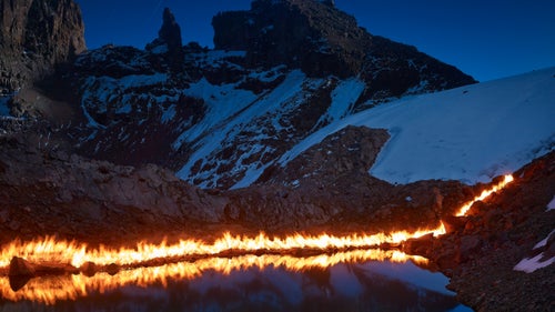
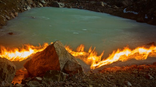
In 1947, the year marked by this fire line, the water was 50 feet higher and the back of the pond was a small cliff of ice. Lewis Glacier is one of the most surveyed tropical glaciers in the world and scientists have been studying it closely for decades. The abundance of information made it a perfect subject for Norfolk and this project.
A wider view of Norfolk’s residence, the Austrian Hut. This portion of the glacier has receded 935 feet since 1963. The crack between the upper and lower portions of the glacier, depicted by the two fire lines, has also grown.
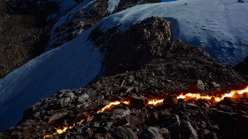
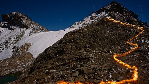
The crack of dirt, seen in the middle of the frame, has extended nearly the entirety of the glacier’s width in recent years. The lower half is no longer fed by the top and will likely be the next section to melt.
The flame line shows Lewis Glacier’s position in 2004. This is a relatively stable portion of the glacier, but it has still receded over 70 feet in the last decade.
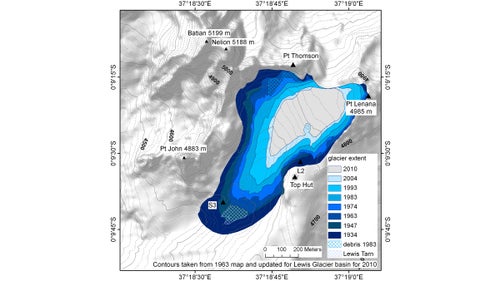
The bright orange fire lines of Norfolk’s project are just another way to represent the recession of the glacier through the years. Here, a color-coded maps shows just how much of Lewis Glacier is disappearing.