Planning spring break is high pressure. You only get a one-week respite from school or work, and the timing, late March or early April, makes it tough to find a location with consistently good weather. Those months could offer spring ski conditions or prime surf weatherтАФor not.
More than a few times, IтАЩve had to pivot at the last minute, having thought it would be warm enough for family surfing on the Outer Banks for spring break and then found temperatures in the low 50s. We moved our vacation further south.
Yes, south is the operative word. So relax, because IтАЩve found seven national-park units in the Southeast and Southwest that offer gorgeous landscapes, many daysтАЩ worth of adventures, and just-about-guaranteed warm weather for the perfect spring break trip.
1. Cumberland Island National Seashore, Georgia
Best for: Swimming, Camping, and Contemplating History
Average Temperatures in March and April: Highs from mid 70s to mid 80s
Cumberland Island is wild. The largest barrier island off the coast of Georgia, Cumberland is a 17-mile-long, 36,000-acre swath of pristine beaches, tall dunes, maritime forests, fresh lakes, and marshy canals. Even though the Carnegie family once owned the island, and descendants still have some private property, Cumberland protects almost 10,000 acres of federally designated wilderness. The only way to reach the island is by a 45-minute ($20 one way) or private boat, and once youтАЩre there the only way to get around is by foot or bike on hiking trails and 50 miles of sandy roads.
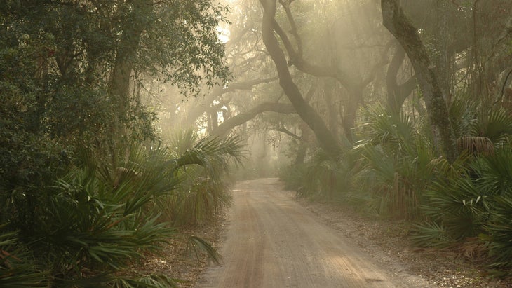
The island has no stores, so bring everything youтАЩll need, and be prepared to pack it all back out. YouтАЩll see some ruins from a Victorian-era mansion built in 1884 as a winter home for Thomas Carnegie, as well as the remnants of a freedmenтАЩs community of former slaves. You may spot members of the colony of feral horses that still roam the island, which are likely descendants of the horses brought over by the British during the War of 1812.
As for beaches, Cumberland offers 15 miles of undeveloped sand and dunes facing the Atlantic. For solitude, keep heading north away from the docks until you reach a patch of sand thatтАЩs too far for day-trippers to claim. ItтАЩs tough to find this much raw beach on the East Coast, so soak it in. The Atlantic is rough, but fine for swimming. Stay out of the marshes on the west side of the island, as theyтАЩre popular hangouts for alligators.
Where to Stay: is an all-inclusive hotel operating in one of the CarnegiesтАЩ former vacation homes (from $895 a night), but most visitors . Sea Camp has bathrooms and showers and allows fires (from $22 a night). Stafford Beach is more remote, requiring a three-mile hike from the docks, and it, too, has bathrooms with showers (from $12 a night). Book your spot early, up to six months in advance.
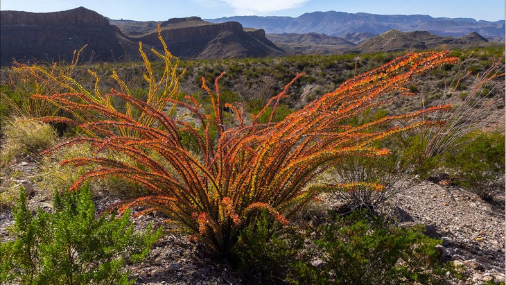
2. Big Bend National Park, Texas
Best for: Hiking, Biking, Climbing, Canoeing, Stargazing
Average Temperatures in March and April: Low to high 70s
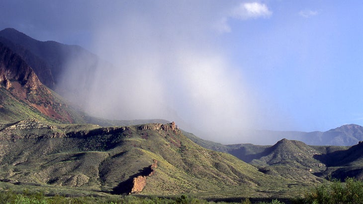
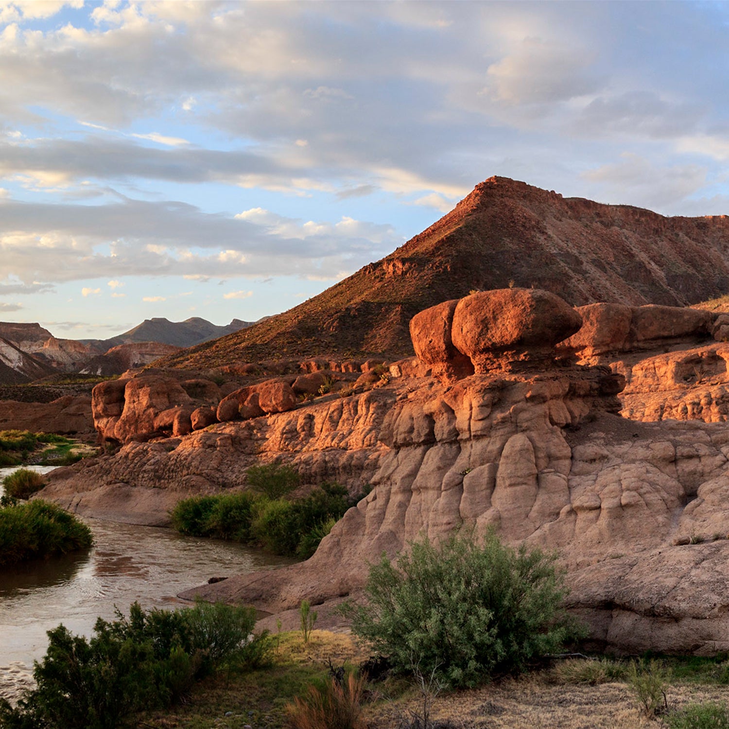
The 800,000-acre Big Bend National Park has been a spring-break destination for decades. My mother-in-law still talks fondly about spending college spring breaks camping there during the 1960s.
Late March and early April are the busiest times to visit the park. But тАЬcrowdedтАЭ is a relative term; I hit the place a few years ago at the end of March and never felt overwhelmed or discouraged by other visitors, mainly because the park and its neighboring Big Bend Ranch State Park are so large. I hiked, rode my bike, camped, and enjoyed the тАЬFar West TexasтАЭ vibe of it all.
The Big Bend landscape is straight out of a Western, with its vistas of canyons, the towering Chisos Mountains, and big stretches of rocky desert. ItтАЩs a great place to explore by boot, bike, or boat, an ideal multi-sport national-park trip.
Hikers should tackle the 5.5-mile out and back Window Trail, which descends 1,000 feet from the Chisos Trailhead, at 5,400 feet elevation, through Oak Creek Canyon to a sheer drop-off framed by towering cliffs. Be prepared (and take water) for the steady climb back to the trailhead. Depending on recent storms, there could be a small stream in the center of the canyon, but the trail is still navigable. Subject to changes in the water level, you can paddle a 20-mile section of the Rio Grande through Santa Elena Canyon, which narrows to 100 feet wide, with limestone cliffs blotting out the sun. The area has been in a drought for the last couple of years, so spring trips arenтАЩt guaranteed, but check with for water levels and trip options (from $160 per person).
Rio Grande Angell Expeditions video by Taylor Reilly
Just outside the national park is , with its bounty of mountain biking, where you can pedal to a backcountry oasis and through a slope filled with sparkling gemstones. Regardless of what you do, at the end of the day you must soak in the historic hot springs that are carved out of the Rio Grande.
Where to Stay: Chisos Mountain Lodge inside the park has 72 rooms, a restaurant, and a general store (from $170 a night). has 60 sites up almost a mile high in elevation; make reservations up to six months in advance ($16 a night).
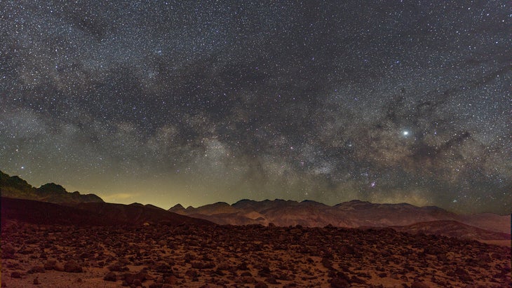
3. Death Valley National Park, California
Best for Cycling, Hiking, Stargazing
Average Temps in March and April: Highs from 65 to 75
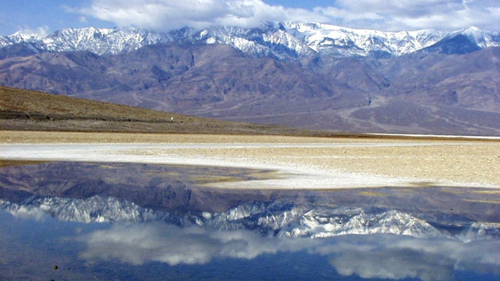
It would be borderline crazy to visit Death Valley National Park in the summertime, but in early spring, the temperatures are chefтАЩs-kiss perfect. Visitors in spring may also have the huge bonus of seeing the wildflowers pop off, particularly in the lower elevations, in fields of desert gold, poppies, and verbena. If youтАЩre really into hitting the park during peak flower power, watch the rangersтАЩ on which wildflowers are blooming throughout spring and summer.
Also cool: the park is home to one of the worldтАЩs rarest fish, the Devils Hole pupfish, an endangered species found only in a water cavern in Devils Hole here. The pupfish are visible during the annual spring migration as they move within the hole seeking warmth from direct sunlight. Scientists counted 191 of them last April, the highest count in 25 years.
You donтАЩt need to be a cyclist to enjoy Death ValleyтАФthere are plenty of hiking trailsтАФbut two wheels is a hell of a way to explore this landscape, with 785 miles of roads open to bikes. Cruise through otherworldly terrain like salt flats, expansive sand dunes, and red-rock formations, before climbing into mountains of up to 11,000 feet.
ArtistтАЩs Drive, a paved nine-mile one-way loop, is the parkтАЩs signature ride. It climbs from below sea level to 880 feet above it, offering views of the surrounding moon-like white sands and mountains on the horizon. At the crest, youтАЩll be surrounded by pink and tan hills, which narrow to canyon-like proportions on the fun downhill to finish the loop. To give you a sense of the terrain, parts of the Star Wars franchise were filmed off this road.
Where to Stay: If youтАЩre looking for nice digs, will put you in the heart of the action, and with a pool (from $507 a night). is the best developed campground in the park, with 136 sites on the valley floor and mountain views. Book up to six months in advance (from $30 a night).
4. White Sands National Park, New Mexico
Best for Hiking and Sand Sledding
Average Temperatures in March and April: 70 to 80
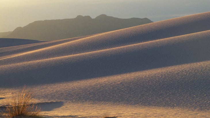
One of the newest national parks (established in 2019), White Sands isnтАЩt huge, just 175,000 acres, but it protects half of the worldтАЩs largest gypsum-crystal field. The dunes roll through the Tularosa Basin like bright white waves, creating a landscape unlike anything else on this planet. You can see the San Andres Mountains on the horizon beyond the park, but itтАЩs the sloping dunes that will mesmerize you.

The eight-mile Dunes Drive scenic road delivers you into the center of the dunes from the comfort of an air-conditioned vehicle, and the road also accesses the parkтАЩs five different hiking trails. The Dune Life Nature Trail is an easy one-mile loop that serves as a good intro to the landscape. But if you really want to dig into the dunes, hike the five-mile , which traces the edge of an ancient lake that has been replaced by the waves of dunes. YouтАЩll climb and descend 60-foot sandy mounds throughout.
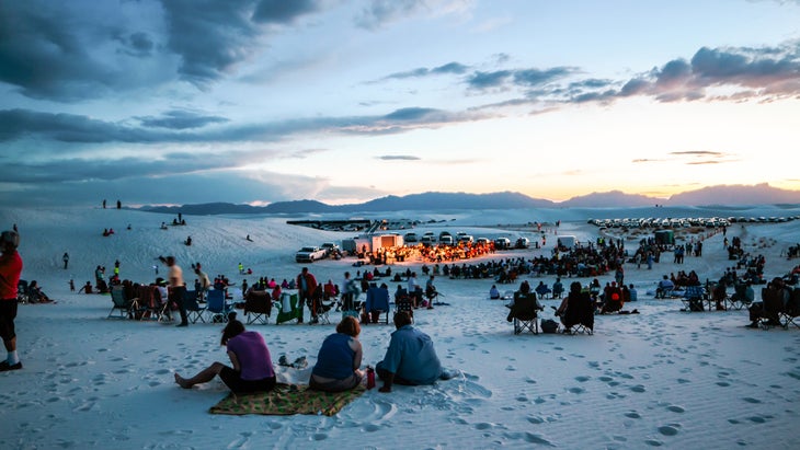
If you can time it right, hit the park on a , when White Sands is open into the night, and ranger-led programs include guided hikes. And definitely bring a sled (or buy one in the park gift shop). The dunes at the are open to sledding, and the gypsum hills behave exactly like snow slopes.
Where to Stay: There is currently no camping inside the park: its backcountry campsites are closed for rehabilitation, with no timeline as to when they will be in service. The town of Alamogordo, 15 miles east of the park, has a variety of chain hotels.
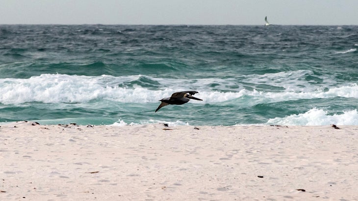
5. Gulf Islands National Seashore, Florida and Mississippi
Best for Island Hopping, Swimming, Surfing, Fishing, Birdwatching
Average Temperatures in March and April: Low to mid 70s
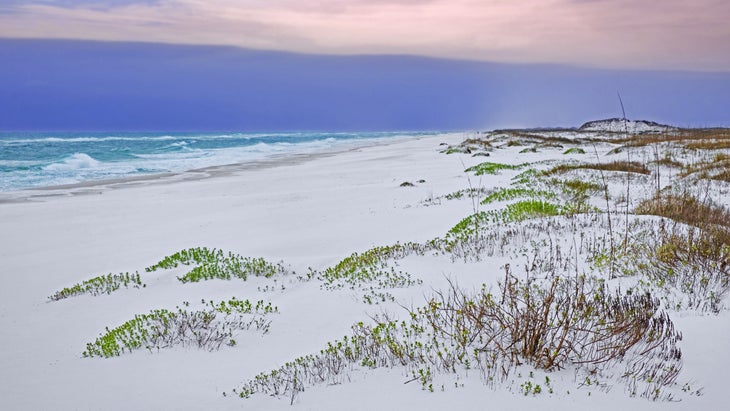
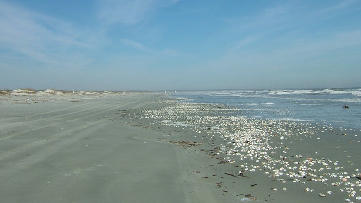
A lot of people have discovered the Gulf Islands National Seashore. In 2023, visitation jumped 40 percent, from 5.7 million to 8.2 million people, making this unit the fifth-most-visited in the park service. People are showing up for the white-sand beaches on the mainland and for barrier islands that you can only reach by boat. The national seashore is made up of a series of parks, beaches, and islands, split between Florida and Mississippi, and all surrounded by clear, aqua-blue waters that are home to gopher tortoises, bottlenose dolphins, starfish, crabsтАжand the 300 species of birds that migrate through the area.
The easiest island to reach is Ship, 12 miles off the coast and accessible by regular from Gulfport and Biloxi ($44 per person, round trip). Once youтАЩre on the island, you can explore the historic fort, lounge on the beaches, or swim in the Gulf. The recreation area is fully developed with concessions and restrooms, so itтАЩs a convenient getaway.

If youтАЩre looking for something wilder, consider venturing to , an eight-mile-long barrier island protected as a federally designated Wilderness area, so there are no commercial ferries to the island and no facilities on the ground. But if you have your own boat or want to hire a charter (from $675 at ), youтАЩll find an island ringed with sugar-white sand beaches and grassy dunes, while pine trees and lagoons pack the interior. Mind the occasional alligator.
Where to Stay: The campground, on the mainland near the town of Ocean Springs, sits inside a maritime forest, with marshes and fishing docks ($25 a night, book six months in advance). YouтАЩre also allowed to on the beach on a few of the barrier islands (Petit Bois, West Petit Bois, and Horn Island) inside the park, but stay off the dunes and any vegetation, donтАЩt bring any mechanical devices (ie, no coolers with wheels), and be prepared for a true wilderness experience, as there are no facilities.
6. Glen Canyon National Recreation Area, Utah and Arizona
Best for Boating, Swimming, Hiking
Average Temperatures in March and April: Highs from 60 to 69
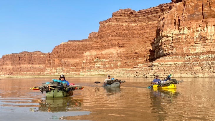
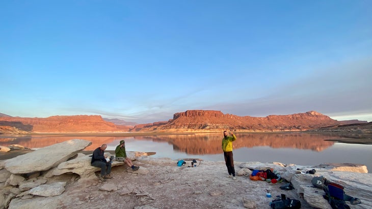
Glen Canyon protects the incredible 1.25 million acres of land and water where the Colorado River pours into Lake Powell. The blue water of the lake contrasts sharply with the red and pink sandstone walls that rise directly from the edge, and the lake has countless fingers and canyons to explore by boat.
The water levels of Powell are constantly shifting, and have generally been in decline the last 20 years. Check the park siteтАЩs to make sure the boat ramp or launch you have in mind is operational. The lake was low when I visited a few years ago on a biking and paddle trip, and we had to contend with some mud on the banks, but the place was no less stunning.
The Antelope Point ramp typically has the least boat traffic, so itтАЩs conducive to use of kayaks or canoes. From there, you can head south on the lake for a mile and paddle into Antelope Canyon, a narrow slot canyon thatтАЩs also a no-wake (no motorboating) zone. Under normal water levels, you can follow the creek upstream for about a mile. offers rental kayaks (from $75 a day). You can also launch directly from the beaches at Lone Rock Beach and Stanton Creek and explore the lake surrounding those alcoves.
Off the water, an easy 1.25-mile hike leads to one of the overlooks at , where the Colorado River takes a drastic turn around a massive sandstone escarpment.
Where to Stay: All inside the recreation area are first-come, first-served. Lees Ferry Campground has 54 sites, potable water, and restrooms ($26 a night). Lone Rock Beach has primitive sites on a sandy beach right next to the water ($14 per night).
7. Grand Canyon Parashant National Monument, Arizona
Best for Overlanding, Hiking, and Seeking Solitude
Average Temperatures in March and April: High 50s to mid 60s
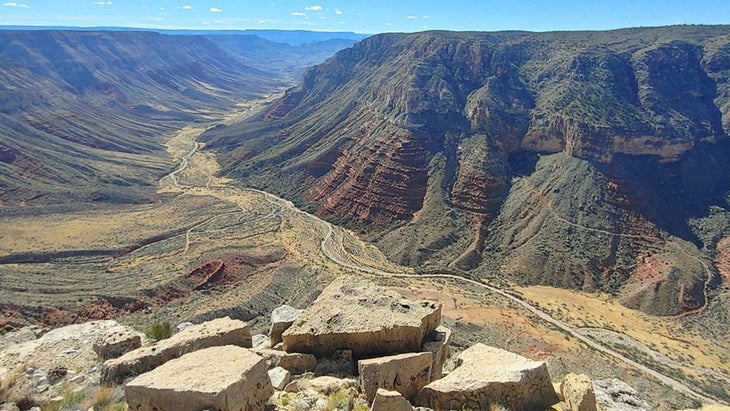
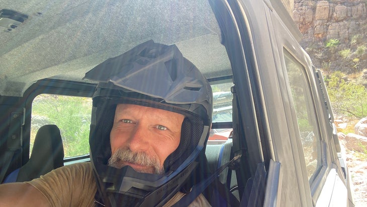
The Grand Canyon-Parashant National Monument is primitive. This Northern Arizona park has no facilities, no campgrounds, and no paved roads. Instead, visitors are treated to the sights of 1 million acres of expansive plateaus, rugged canyons, and Mojave Desert, all traversed by a series of unimproved dirt roads and hiking trails. In other words, this monument is ideal for self-contained overlanding. I spent three days cruising Grand Canyon-Parashant in a side-by-side with a rooftop tent, while hiking and biking at various spots throughout, and was as mesmerized by the solitude as the grandeur of the landscape.
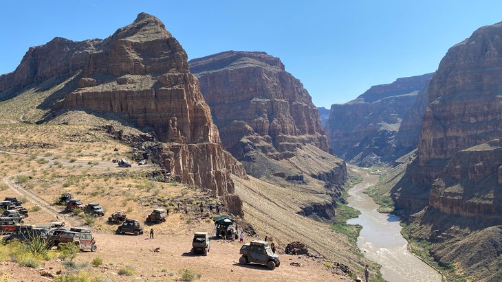
If you have a high-clearance 4WD vehicle, the monument is yours to explore. The park service details an 80-mile adventure to that cruises through a variety of terrain, from cattle fields to ponderosa forests, and ends on the north rim of the Grand Canyon. If you choose this route, youтАЩll also have the chance to get out and stretch your legs on the Burnt Canyon Trail, an easy three-mile out-and-back on a grassy road bed that leads to a big view of the western edge of the Grand Canyon. On a clear day, you can see all the way to Mount Charleston, just outside of Las Vegas.
I took a roundabout, multi-day route to reach , with its long view into the Canyon, and an optional side hike down to the water. The last seven miles to Whitmore Point drop 1,500 feet over rocky, rutted terrain that was super fun to bomb on a mountain bike. The fastest way to this perch is a 50-mile traverse from Mount Trumbull Schoolhouse.
Where to Stay: Primitive camping is allowed throughout the monument, but if youтАЩre looking for a bit of refinement in the midst of all this rugged adventure, the has hotel rooms and covered wagons on an inholding close to the northern rim of the Grand Canyon. ItтАЩs only accessible by a 70-mile dirt-road drive through the national monument or an airplane (the place has its own landing strip), but once youтАЩre there, youтАЩll be able to refuel your vehicle and have a damn fine dinner (starting at $172 a night).
Graham Averill is ╣·▓·│╘╣╧║┌┴╧ magazineтАЩs national-parks columnist. Every year, he agonizes over how to maximize his kidsтАЩ spring break, dragging them to campsites in Florida, beaches in South Carolina, and lakes all over the Southeast. He recently wrote about hiking in Joshua Tree National Park and his absolute favorite mountain town on the East Coast. His latest article is all about visiting national parks for free.