
is only a few hours north of the state’s most famous attraction, the , but most people have never heard of the stunning wilderness area, much less visited its swirling, colorful sandstone. There’s a reason for that—getting to know the monument isn’t easy. While the stunning 2,000- to 3,000-foot namesake cliffs run for 30 miles and can be viewed from U.S. Highway 89A, getting to the monument’s other treasures takes a little effort. There’s no visitor center, no paved paths, and only a few hardscrabble trails. But once you make it into this truly wild backcountry, most of which is protected as a wilderness area, it’s a chance to experience sherbet-colored slot canyons, sandstone arches, and endangered California condors. Before you head into one of Arizona’s best-kept secrets, make sure you have plenty of water, a pair of broken-in hiking boots, and your sense of awe.
Through-Hike Paria Canyon
At the northern end of the monument is , the best nontechnical canyoneering trip in the U.S. Typically, hikers take three to seven days to traverse the 38-mile sandstone canyon. The opposite of the wide-open spaces surrounding it, Paria is a world of walls, with 500- to 1,000-foot sandstone edifices occasionally opening into meadows of willow and rabbitbrush before squeezing back together. The goal is to simply keep your feet wet and follow the river, looking up often at the swirling sandstone and ribbon of blue above as light changes them hour and hour and minute by minute on the trip down to Lee’s Ferry. Tip: While day hiking in the canyon is permitted, the BLM issues only 20 overnight permits per day—so make your reservation early.
See Arizona’s Most Famous Wave
On the north edge of Paria Canyon lies Coyote Buttes North, a day-hiking area that is also restricted to 20 visitors per day. The limit is to protect what may be the Southwest’s most beautiful natural attraction, an area known as The Wave. The petrified ocher sand dunes twist through the landscape, creating what look like optical illusions. Hit it at the right time and the deep, sinuous gullies will be glimmering with pools of water. The Wave is not the only sight to see. The 7.4-mile out-and-back hike also passes stunning features like the Second Wave, Melody Arch, Sand Cove, the Alcove, and the Boneyard.
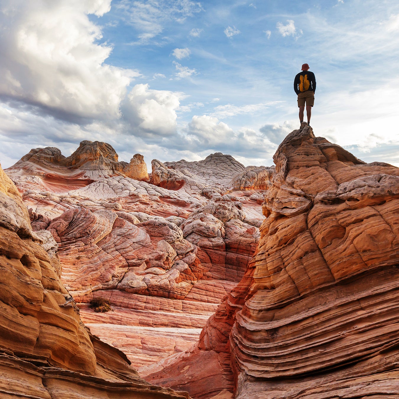
Photograph White Pocket
Unlike other parts of Vermilion Cliffs, the section doesn’t require a permit to visit it. But that doesn’t mean getting there is easy. It takes an ATV or high-clearance vehicle to reach the slickrock formation, but it’s worth the effort. No one is certain what geologic process took place in the Pocket—whether the area was liquefied by an earthquake or subjected to massive heat and pressure—but whatever happened here, it created something totally unique. The entire area is covered in candy-striped layers of rock hardened into waves, studded with brain-like formations, unusual cones, and mounds of white rock. Photographers, in particular, might want to consider camping near the White Pocket trailhead to get the best evening and morning light and even some night sky shots. Better yet, sign on for one of the increasingly popular White Pocket photo tours to get the angles right the first time.
To plan a trip to Arizona’s Vermilion Cliffs or one of Arizona’s other stunning wilderness destinations, go to .