

It’s all too easy to find yourself in a rut when deciding where to run, ride, climb, or ski each day. Maybe you’ve never deviated from the five-mile loop around your neighborhood that you discovered when you first got into running, or you’ve only ever climbed at one crag that a friend introduced you to years ago. Whatever the case, when you want to explore more places for your favorite activity, you don’t have to wait for someone to take you there—get the directions on these apps, and head there yourself.
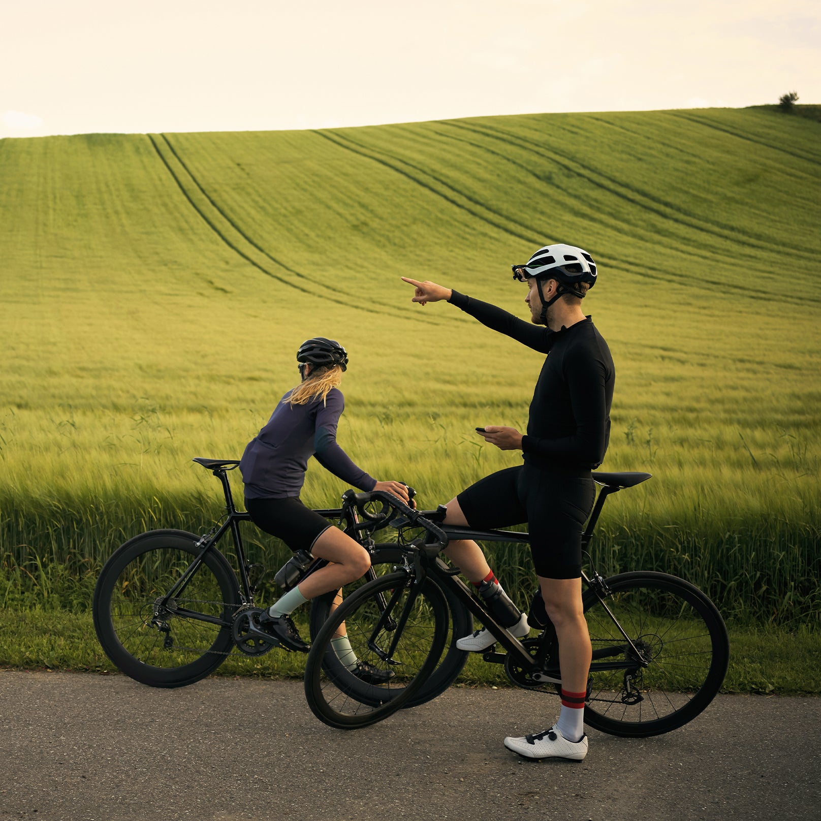
Best For: Running, Cycling
If you’d asked us a year ago, we would have recommended or over Strava for planning basic running and biking routes. Strava, long a favorite for tracking runs and rides and comparing workouts against friends, previously didn’t offer much in the way of mapmaking. That’s changed in a big way since the company introduced , with an algorithm that suggests loops based on your location and preferred mileage; it also takes into account which roads other athletes frequently track activities on. (You’ll need a $5-per-month subscription to Strava to access the feature.)
Using Strava is relatively simple and intuitive, too. Find Routes in the app’s Maps tab. Choose your current location (or one elsewhere), pick your sport, and select your elevation, distance, and surface preferences. You’ll then see a list of suggested routes, which you can edit or save. Alternately, draw your own route in the app or on the website. For inspiration, overlay Strava’s “global heatmap” to view the most popular places to run and bike nearby. After saving a route, you can follow it during your activity by clicking “use route” and pressing start in the app.
Best For: Mountain Biking
The MTB Project app is free and contains maps, pictures, reviews, and details on over 100,000 miles of mountain-biking trails around the world. The app also allows you to record your rides as you do them.
Search for individual trail segments or full rides—which MTB Project calls Recommended Routes—by scanning the map or typing in a location or trail name. The app also surfaces routes and trails based on ratings from other users. Each Recommended Route offers a short description, driving and parking directions, and notes on whether dogs or e-bikes are allowed. Other data includes how much of the trail is singletrack, its elevation gain, high points and low points, and the average and maximum grades of the trail’s terrain.
In the app, you have to download data for each state or area before you can explore the trails there, but once the map is downloaded, it’s also available offline—handy for those times when you’re navigating trails without cell service.
On the MTB Project website, users can submit photos, updates on trail conditions, and comments on each trail or route. The company, , has a staff of editors who review everything posted by users to ensure accuracy.
Best For: Hiking
AllTrails is like the Yelp of hiking: it features more than 200,000 trails, each with a star rating and an extensive list of personal reviews.
AllTrails tags hikes with categories like best waterfalls, weekend worthy, and dog friendly. When searching for a hike, you can sort by popularity, distance, difficulty level, and preferred amount of elevation gain. It’s also possible to filter for details like heavy trail traffic, wheelchair friendliness, and more.
While the detailed reviews, driving directions, and photos attached to each trail in the free version of the app provide lots of information, it’s worth paying $29 a year for AllTrails Pro so you can download trail maps and view them offline. When you’re hiking without cell service, it’s extremely convenient to pull up the downloaded map of your route in the AllTrails app to see your location and make sure you haven’t veered off track.
Best For: Backpacking
Gaia GPS offers more detailed maps and GPS features than AllTrails, making it the better option for multi-day backcountry trips. If you pay $39.99 for an annual premium membership, you get access to —long considered the gold standard of maps for many of the world’s most popular outdoor destinations. (Gaia GPS is owned by the same parent company as �����ԹϺ���, and Gaia GPS Premium is now included with an .) But with 251 other map sources powering the navigation in Gaia GPS, you’ll be well served no matter how many, or few, people have trekked where you’re going. A few standout features include the ability to download satellite-image maps, to better see the terrain you’ll be tackling; cell-phone-coverage maps, so you know where you’ll have service; and U.S. Forest Service recreation-site maps, to scope out campsites.
Search for hiking routes in the app’s Search tab, or create your own routes in the Map tab by selecting the “create route” option and clicking where you want to go. All the maps download to your phone quickly for offline use. You can also create and view routes on the Gaia GPS website and sync them to your phone. When you’re using Gaia GPS’s tracking mode in the backcountry, a quick glance at the top of the screen in the app will show you how far you’ve traveled, how fast you’re hiking, and your current elevation.
Best For: Climbing
This one’s a no-brainer: the Mountain Project website has long been the definitive, free crowdsourced route guide for American rock climbers. Its database currently has information on more than across the U.S. In the app, you can download beta to use offline—such as maps, photos, and user comments—for any crag after sorting by location, difficulty, and user rating. You can also bookmark routes for later, record your own attempts and sends, and leave comments easily.
The website’s guides to rock climbing by state include recommended crags and climbs, what each state is known for by its climbers, and tips on where to go, depending on the time of year. Mountain Project’s regional guides—to areas like the Shawangunk Mountains in New York or the New River Gorge in West Virginia—offer more detailed info along the same vein, including where to camp and eat in certain areas. Then, of course, there are guides to individual crags, with info on parking, camping, and dangerous spots.
Best For: Backcountry Skiing
For years, CalTopo was only available online via a desktop—users would import maps they created there into Gaia GPS or another mobile app. Now you can skip that step and use the CalTopo app directly on your mobile device.
CalTopo works much like Gaia GPS, with a few key differences that make it a must-have for backcountry skiing. A slope-angle shading feature allows you to easily visualize the steepness of hills to help keep you out of avalanche terrain. There’s also a wind-plot feature that relays wind speed and direction over an area for any given period of time, which is great for determining where wind-loaded slopes will be. In addition, CalTopo from 850 sensors all over the U.S. to give you the latest readings on snow depth, water equivalency, and air temperature at different sites.