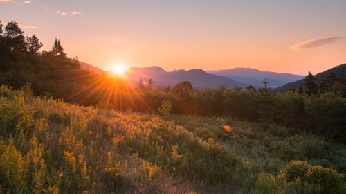

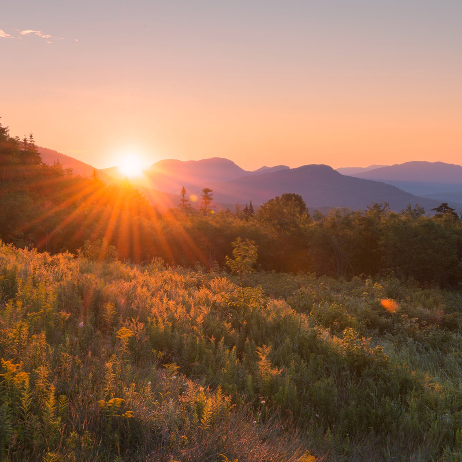
Any visitor to New England looking to escape to the mountains faces one major question: The Whites or the Greens? Both of the Northeast’s dominant ranges offer plenty of opportunities to explore but have markedly different environments.
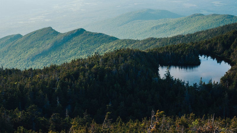
Steep and rugged, the White Mountains are concentrated in north-central New Hampshire, extending from the Connecticut River east to just across the Maine border. The bulk of the range is contained in 796,000-acre , which includes six federally designated wilderness areas and more than 7,700 acres of alpine habitat. Forty-eight peaks in the Whites exceed 4,000 feet in elevation, capped by 6,288-foot Mount Washington, the highest point in the northeastern U.S., the former record holder for the world’s highest wind gust (231 miles per hour), and the site of many infamous climbing and mountaineering stories. An extraordinary network of some 1,250 miles of hiking trails crisscross the Whites, including about 160 miles of the Appalachian Trail. While most forest trails and campgrounds have reopened in both New Hampshire and Maine, be sure to check the of individual sites before visiting.
To the west, across the Connecticut River and the Vermont border, lie the Greens. Gently rolling and thickly forested, the range runs the entire length of Vermont from the Massachusetts border to the boundary of Quebec, Canada. protects 400,000 acres of the range. Within it is 4,395-foot Mount Mansfield, the highest of the state’s five peaks over 4,000 feet in elevation, rising prominently above the ski area of Smugglers’ Notch. The Greens boast more than 600 miles of foot trails, knitted together by the 272-mile . Completed in 1930, it’s the oldest long-distance trail in the country and includes about 100 miles of the AT. The trail opened on May 22 with new , and some overnight and backcountry facilities have at limited capacity as of June 15. Though Green Mountain Association is encouraging day hikes, dispersed camping is allowed at some locations along the Long Trail and AT. (Check Green Mountain Club’s for the latest.)
How to decide between New Hampshire’s White Mountains and Vermont’s Greens? Whether you prefer breathtaking vistas, waterfalls, or multi-day backpacking trips, we’ve highlighted the best outing in each range to help you pick.
If You Want High Peaks and Vistas
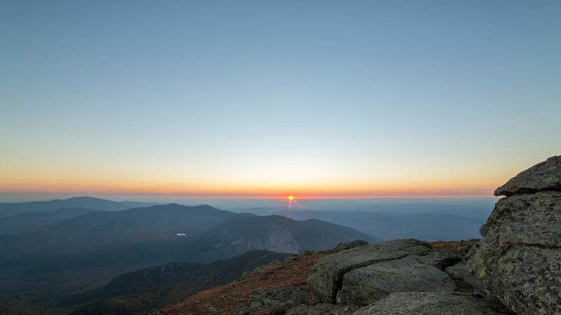
The Whites: Carpeted with delicate wildflowers in early summer, the bald summit of the dome-shaped Mount Eisenhower (4,760 feet) features an impressive 360-degree grandstand over the alpine terrain of the Presidential Range and into the below. Begin from the trailhead at Mount Clinton Road on U.S. Route 302 in , about 20 miles south of the town of Lancaster in central New Hampshire. Ascend via the 2.9-mile , which provides the most direct route to the Mount Eisenhower Loop, a half-mile hike to the summit. 7.1-mile loop, strenuous
The Greens: The distinctive profile of 4,083-foot Camel’s Hump, Vermont’s only 4,000-plus-foot summit without a ski area or any other development, resembles that of a sleeping lion when viewed from the east or west. The panorama from the mountain’s craggy alpine top takes in Lake Champlain, New York’s Adirondacks, and the White Mountains. Start from the eastern base of Camel’s Hump at , a few miles south of the town of North Duxbury, near Burlington. Hike the lower section of Monroe Trail, and continue on to Dean Trail before hitting Wind Gap, which leads to the viewpoint via Long Trail. 7-mile loop, strenuous
If You Want Waterfalls
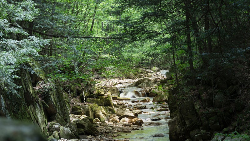
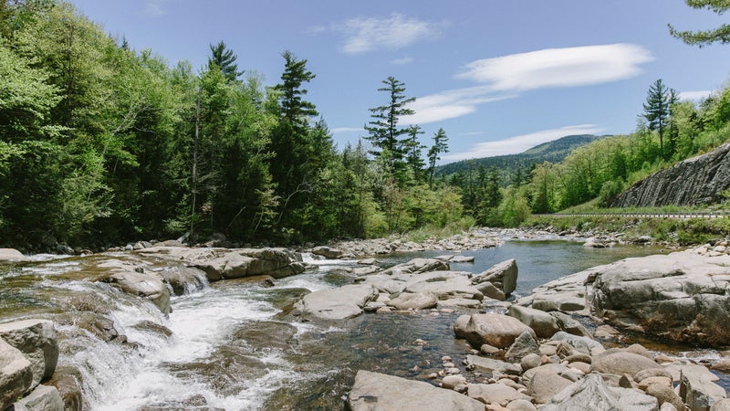
The Whites: Dropping 80 feet down the northwest side of lofty Cannon Mountain are a series of cascades and pools, including the main 35-foot plunge of Bridal Veil Falls. From the trailhead just off New Hampshire Route 116, a few miles north of Easton, the family-friendly Coppermine Trail climbs alongside a brook in a forest of ferns and moss-covered boulders. A log shelter located just a quarter mile across the brook from the falls makes for the perfect lunch spot. 5 miles round-trip, moderate
The Greens: The 125-foot-tall Lye Brook Falls, reached via , is the most impressive natural feature in the , an 18,000-acre forested plateau of streams, ponds, and bogs just east of the town of Manchester Center. From its source deep in the woods on Stratton Mountain, Lye Brook Falls tumbles and surges through a narrow rock chute to a sea of boulders and down into the valley below. Just before reaching the falls, the trail crosses a short stretch of wide-open hillside, the result of a 500-foot landslide caused by the heavy rains of Hurricane Irene in August 2011. 4.4 miles round-trip, moderate
If You Want Backcountry Hiking
The Whites: In north-central New Hampshire near Mount Washington, take a trip into the heart of the 45,000-acre Pemigewasset Wilderness. Start at the roaring Pemigewasset River for a few miles of ambling along the Lincoln Woods Trail, then hike the Franconia Brook Trail to Thirteen Falls and its Appalachian Mountain Club (AMC) tent site. Next, climb the 2.4-mile Twin Brook Trail to Galehead Mountain, one of five 4,000-plus-foot peaks. More tent sites and shelters, including the comfy —one of the most remote huts in the AMC’s system—can be found along the connecting Twinway (part of the AT) and Bondcliff Trails, a beautiful route that leads 11.5 miles over South Twin Mountain, Mount Guyot, Mount Bond, and Bondcliff. 25-mile loop, 2 to 3 days, strenuous
The Greens: Glastenbury Mountain (3,748 feet) and its circa-1927 fire tower are the highlights of an outstanding backpacking circuit through the 22,425-acre . From the trailhead at City Stream on Vermont Route 9, just east of , follow a 10.4-mile scenic stretch of the renowned Long Trail, which passes two shelters, tent sites, and water sources. On the wooded summit of Glastenbury, climb the tower to enjoy the grand 360-degree view. Returning from the tower, the hike continues on the less traveled West Ridge Trail (7.8 miles) and then Bald Mountain Trail for the 1.9-mile descent to the valley. You’ll end at the East Trailhead on Harbour Road, several miles west of the starting point. Arrange a car shuttle or hitchhike to get back to your vehicle. 22-mile horseshoe loop, 2 to 3 days, strenuous
If You Want Easy and Accessible Trails
The Whites: In the village of North Conway, the lower half-mile of Moat Mountain Trail is a mostly level walk leading to a shady grove of hemlocks and , a pretty series of waterfalls, pools, and potholes. 1.2 miles round-trip, easy
The Greens: A few miles south of Mount Mansfield and Smugglers’ Notch, in the village of Stowe, is the , a popular multi-use greenway that winds along the West Branch of the Little River. The paved path features views of the surrounding high peaks and access to local and along its five-mile length. For a short walk, start at the southern trailhead on Vermont Route 100 and head north to Weeks Hill Road; then on the way back, break off on the adjacent Quiet Path, which is bike-free. About two miles, easy
This story was produced in partnership with magazine.